Repository navigation
Heightmap template editor
Template is a set of actions to be applied to get a heightmap. Template can be pretty prescriptive and provide similar-looking heightmaps on each execution, but there is always a significant level of randomness that allow templates to produce different maps of the same type.
The Template Editor is opened from the Tools tab → Heightmap → Erase mode → Template editor.
Possible actions (buttons in the toolbar) are:
| Button | Action | Parameters |
|---|---|---|
| H | Hill — a small blob that raises the surrounding land |
y, x, h, n
|
| P | Pit — a round depression |
y, x, h, n
|
| R | Range — an elongated elevation |
y, x, h, n
|
| T | Trough — an elongated depression |
y, x, h, n
|
| S | Strait — a vertical or horizontal depression across the map |
d, w
|
| M | Mask — lower cells near the edges or in the map center | f |
| I | Invert — mirror the heightmap along an axis |
by, n
|
| + | Add — add or subtract a value from heights in the selected range |
to, v
|
| * | Multiply — multiply heights in the selected range by a factor |
to, v
|
| ~ | Smooth — replace cell heights with the average of their neighbors | f |
Parameter meanings:
-
n— how many blobs to add. Use a hyphen to get a random number in a range, e.g.2-5. For Invert it is instead the probability of inversion, in the0-1range -
h— the target height, from0(deep ocean) to100(maximum height);20is land at sea level. Use a hyphen for a random value in a range -
xandy— placement range as percentages of the map.xruns from 0 at the left to 100 at the right,yfrom 0 at the top to 100 at the bottom. Use a hyphen for a range, e.g.65-75 -
w— strait width, capped at a third of the map width. Values below 1 act as the probability that the strait is created at all -
d— strait direction: vertical or horizontal -
by— the axis to mirror along:x,yor both -
f— fraction:1is the full effect,2blends the result half-way with the original, and so on. For Mask a negative value inverts the effect -
v— the value to add (may be negative) or to multiply by -
to— which cells the change applies to: all cells, land only (height 20 and above, and never pushed below 20), or interval, which prompts for a custom height range like17-20
A step can be skipped by clicking the check icon on its left, removed with the trash icon, and reordered by dragging the double-arrow handle.
To run the template click ▶ or press Enter. The heightmap is reset to zero before the run, so the template always starts from a blank map. The undo / redo buttons step through the result of each action. If you enter a Seed, the template produces the same heightmap on every execution; leave it empty for a new random seed each run.
The remaining buttons let you download the template as a text file, upload a previously saved one, and open the Cartography Assets portal to find or share templates.
The Select template dropdown loads one of the built-in templates as a starting point: Volcano, High Island, Low Island, Continents, Archipelago, Atoll, Mediterranean, Peninsula, Pangea, Isthmus, Shattered, Taklamakan, Old World and Fractious. Selecting a template discards the current steps.
When you open the Template Editor, the instruction is like this:
Hill n:1 h:90-100 x:65-75 y:47-53
This says to add 1 hill, of a random height between 90-100, somewhere in the center-right of the map.
To test it, change the Hill entry to:
Hill n:1 h:20 x:50-50 y:50-50
If you click Execute template, it will show a map with just a few land cells right in the map center.
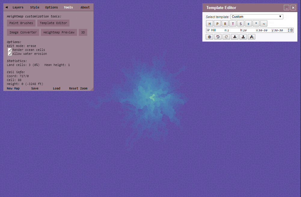
I suggest you enable "Render ocean cells" option to see the effect it has on the ocean depths.
Now change n:1 to n:2
You will see massive change — this is because the land has been raised by 40 height in total.
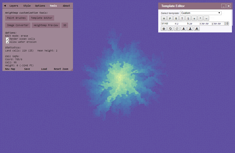
Hills are main 'bricks' that construct a heightmap.
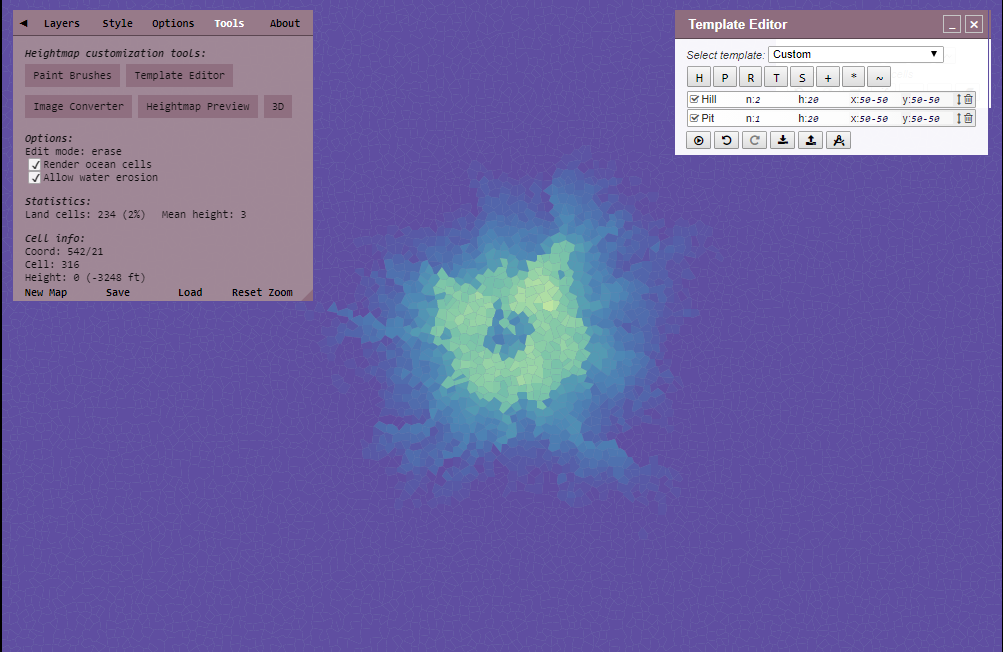
Pit is the opposite of Hill, it creates a "hole".
To test it, add a Pit so your instructions look like this:
Hill n:2 h:20 x:50-50 y:50-50Pit n:1 h:20 x:50-50 y:50-50
Run it and you will see a hole — the exact look will vary a bit.
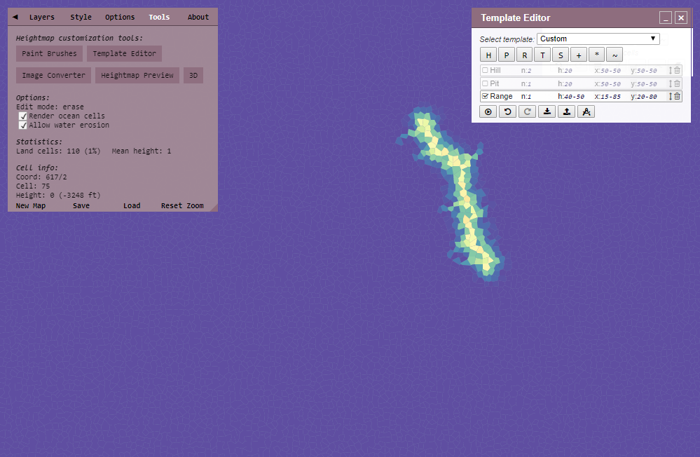
Add a range and disable the Hill and Pit entries.
You will see it makes an elongated raised area.
Range n:1 h:40-50 x:15-85 y:20-80
If you change the Range and enable the Hill and Pit, you will see that it combines:
Hill n:2 h:20 x:50-50 y:50-50Pit n:1 h:20 x:50-50 y:50-50Range n:1 h:40-50 x:50-60 y:50-50
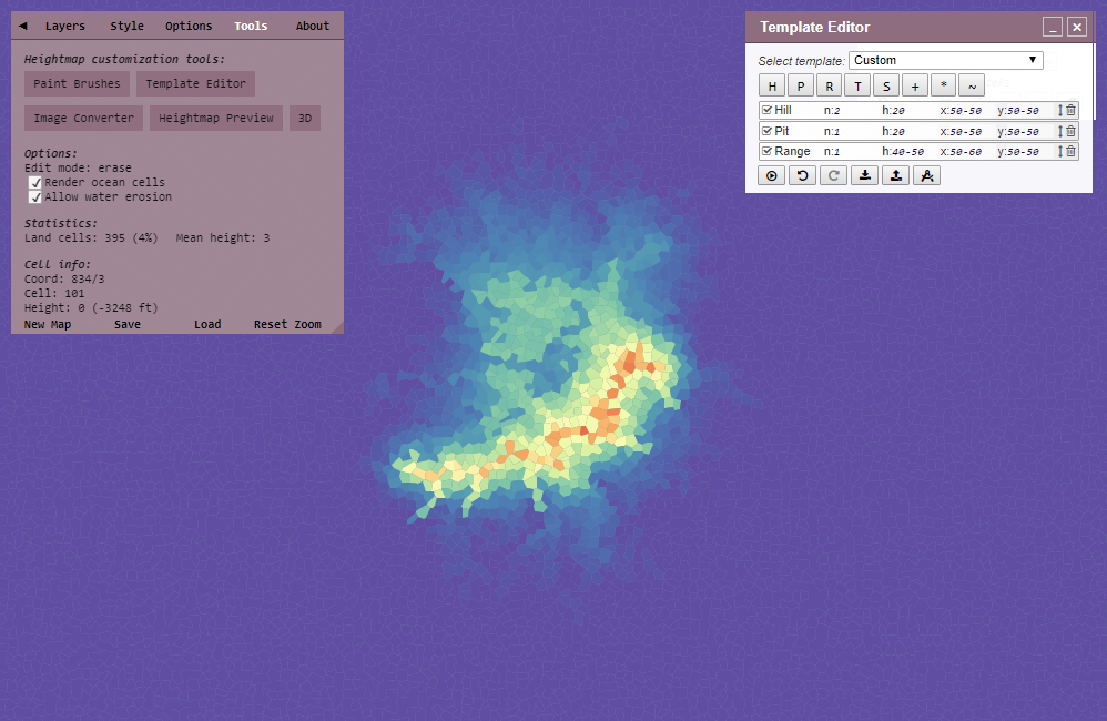
Trough works exactly like Range, except that it lowers height.
Delete all the instructions and click the + button to get the Add instruction. Add changes height by a fixed value — a negative value lowers it.
Change v to 20 so the line looks like this:
Add to:all cells v:20
Run it and the whole map becomes land at sea level — remember that 20 is the minimum land height.
Now add a Strait. It has only two values, direction d (vertical or horizontal) and width w.
Run it and you will see the land divided by a channel somewhere — note that you cannot control the exact location, only the direction.
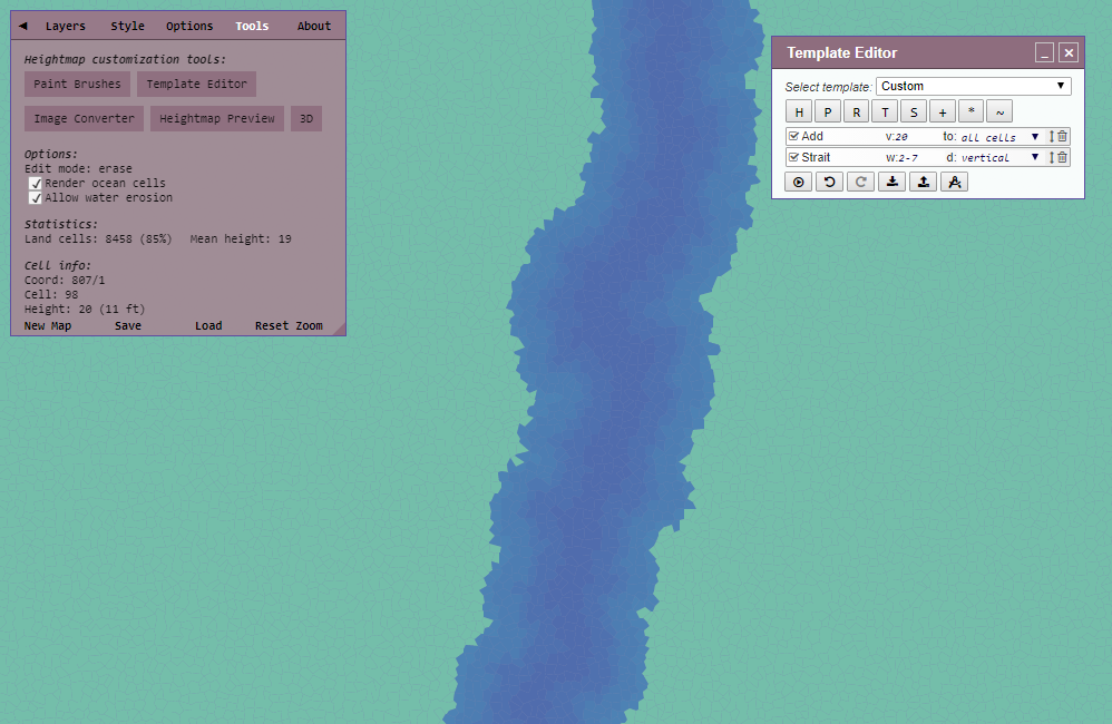
Multiply works like Add, except it scales the existing height, which gives finer control: multiplying by 1.1 raises land slightly, with smaller changes to low values and larger changes to high ones. Values below 1 lower the heights, so multiplying by 0.8 flattens everything a bit. With to:land only the scaling is applied relative to the sea level of 20, so land never drops below the coastline.
Smooth averages cell heights with their neighbors' heights. The fraction f controls the strength: 1 replaces the height with the plain average, 2 blends it half-way, and so on. This means land next to a pit will lower, and land next to a hill will rise. Smooth removes any spiky bits near land and makes FMG performance better.
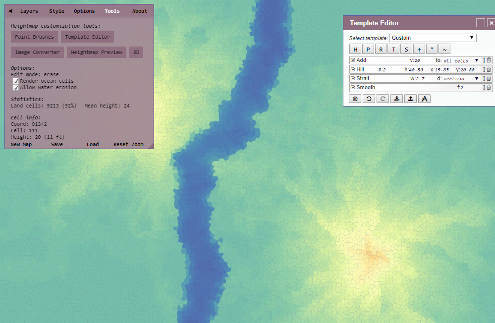
To see what Mask does, assign maximum height (100) to all cells and then add a Mask with the default fraction f:1. It gradually masks the height of the cells along the map edge down to 0.

Fraction 2 blends the masked values with the original ones, so map edges keep a height of 50.

A negative fraction inverts the mask, so cells in the map center are lowered instead.

The fraction can also be a decimal value.

Invert mirrors the heightmap along the X, Y or both axes. It is useful for maps that lean towards one side. Set n to the probability of the mirroring happening, in the 0-1 range, so that only some of the generated maps get flipped.
